


20180306-Mesnil-Esnard

doudet
User

Length
11.2 km

Max alt
209 m

Uphill gradient
333 m
Km-Effort
15.6 km

Min alt
8 m

Downhill gradient
332 m
Boucle
Yes
Creation date :
2018-09-11 09:10:35.995
Updated on :
2018-09-11 09:10:35.995
3h33
Difficulty : Medium

FREE GPS app for hiking
 SityTrail
IGN / Geographical institutes
SityTrail Plus
The world is yours!
About
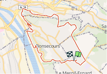
Trail Walking of 11.2 km to be discovered at Normandy, Seine-Maritime, Le Mesnil-Esnard. This trail is proposed by doudet.
Description
Boucle A-R au départ de l'Eglise de Mesnil Esnard
Mesnil-Esnard-Sente des Trésoriers-Mont Gargan-Point de vue Cote Ste Catherine-Pont D'Eauplet-Chemin de Crosne-Mesnil Esnard
Positioning
Country:
France
Region :
Normandy
Department/Province :
Seine-Maritime
Municipality :
Le Mesnil-Esnard
Location:
Unknown
Start:(Dec)
Start:(UTM)
365043 ; 5475440 (31U) N.
Comments